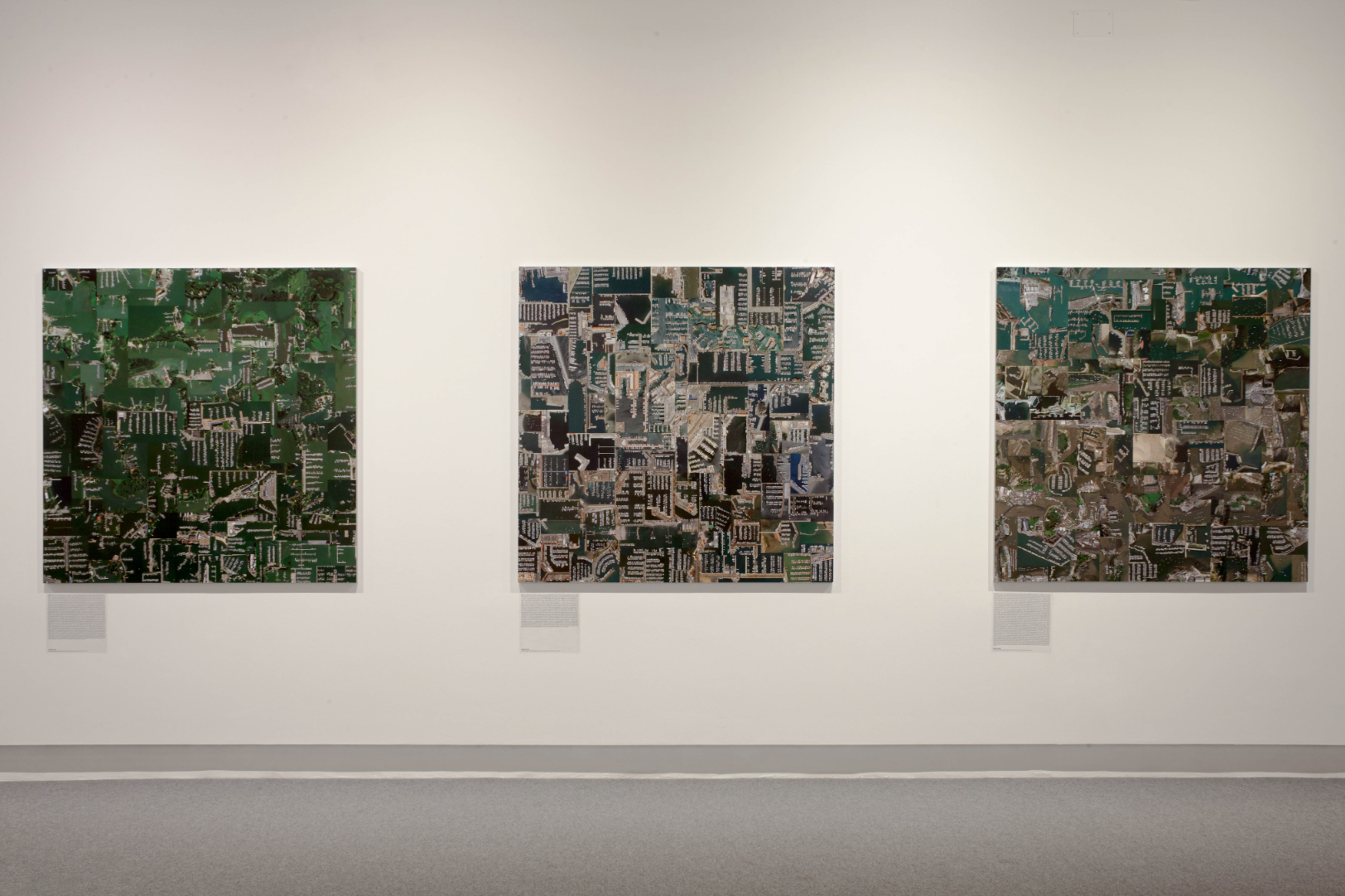
Islas, Puertos deportivos (Islands, Marinas) 2018
Digital print, 150 x 150 cm each. La Térmica, Málaga
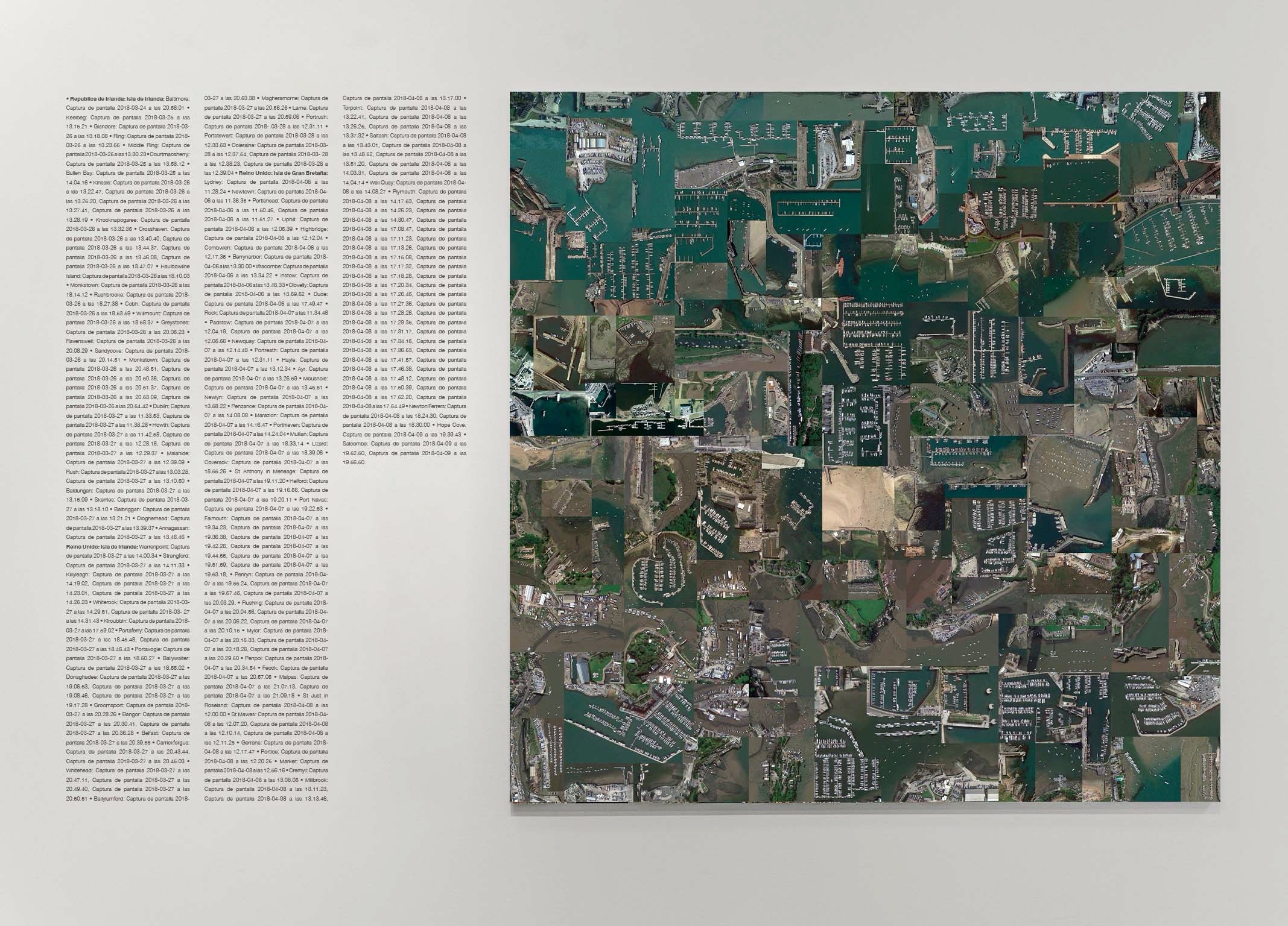
El proyecto Islas es un recorrido visual por los puertos deportivos que se han construido en el litoral. Son imágenes capturadas de Google Earth, en vista cenital, tomadas a cuatrocientos metros de altura y posteriormente reorganizadas por el mismo orden que designa la linea de costa. El resultado es un collage cuadrado de gran formato que se presenta acompañado por un texto donde figuran todas las capturas de pantalla que lo componen. En ellos se pueden leer el nombre de la ciudad y país al que pertenecen, con fecha y hora de su captura.
El trabajo se comprende con la visión global de los collages y sus títulos. Todos los collages tienen el mismo tamaño pero la longitud de los títulos varía. Este factor está ligado principalmente a las políticas que se han desarrollado en las distintas ciudades de costa. Cuando las construcciones portuarias son poco invasivas en el mar, las imágenes de los puertos son pequeñas y es necesario un gran número de capturas para completar el formato, dando un título extenso. Por lo contrario, cuando los puertos son de mayor calado, las grandes imágenes completarán el formato con un número menor de capturas y el título será menor.
Islas quiere ser una herramienta para interrogar sobre la erosión del litoral, la transformación del paisaje, la utilización de las infraestructuras portuarias, los condicionantes que materializan su construcción y analizar su gestión según aspectos políticos, económicos y/o estéticos. Entender la serie como una forma de investigación, un mecanismo para pensar con las imágenes.
En la distancia, la presencia de los barcos tiende a difuminarse. Se convierten en elementos compositivos dentro de una gran isla estructurada y administrada.


España: Tarifa: Captura de pantalla 2018-04-12 a las 19.24.12. Algeciras: Captura de … (Right: detail of enlarged image)


República de Irlanda: Isla de Irlanda: Baltimore: Captura de pantalla 2018-03-24 a las … (Right: detail of enlarged image)

Finlandia: Mäntyniemi : Captura de pantalla 2018- 03-03 a las 19.07.09. Tallbacka : Ca… (Right: detail of enlarged image)

Islas (Island) 2018. General view. La Térmica, Málaga

Creadores 2018. General view. La Térmica, Málaga
